Justin du Toit
Home
Downloads
Final Report of the Drought Investigation Commission, 1923
RSW 2024
Final Report of the Drought Investigation Commission, 1923
Front matter
Final Report
Appendix A (
Part 1
,
Part 2
,
Part 3
)
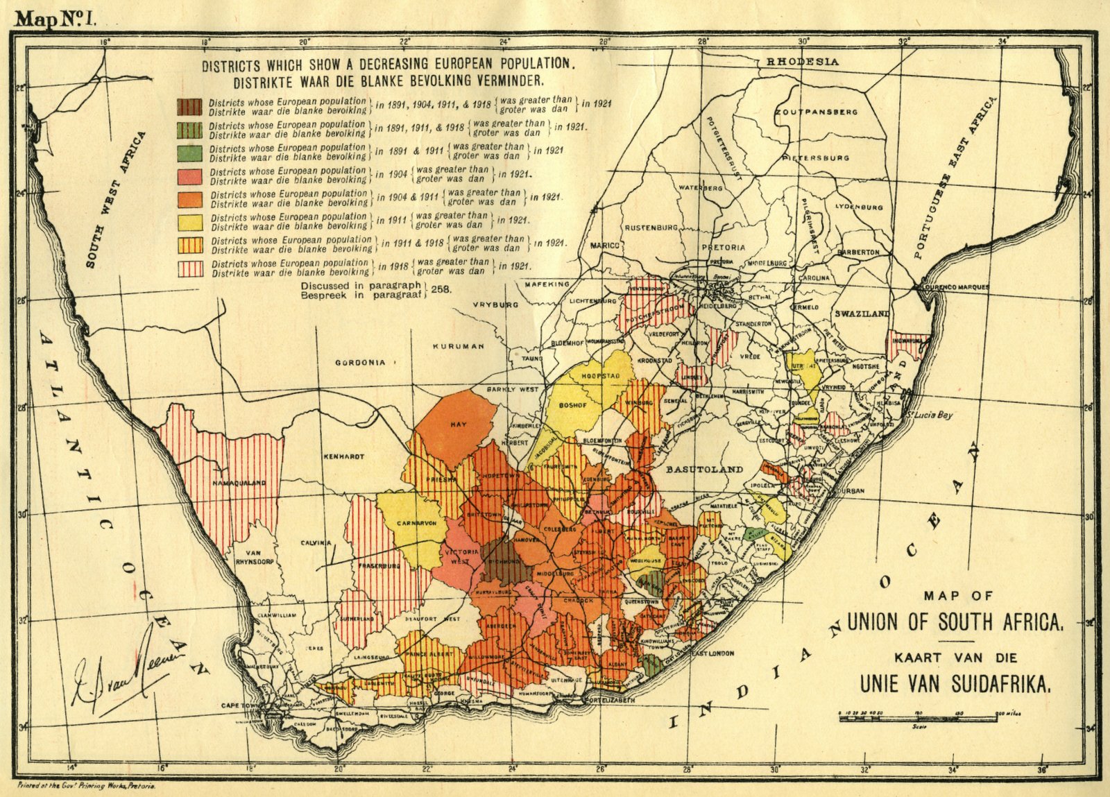
Map I. Districts which show a decreasing European Population
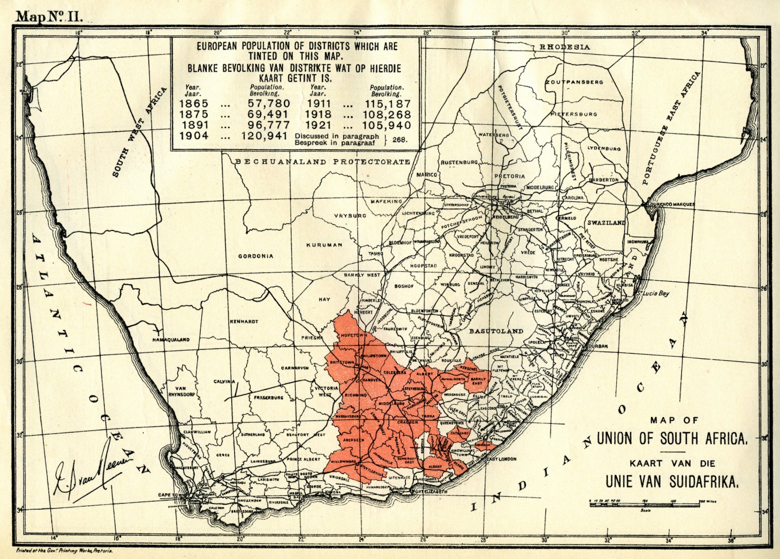
Map II. European population of districts which are tinted on this map
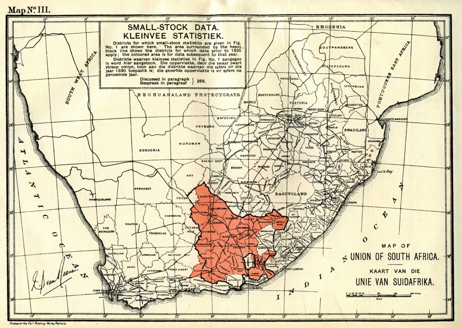
Map III. Small-stock data
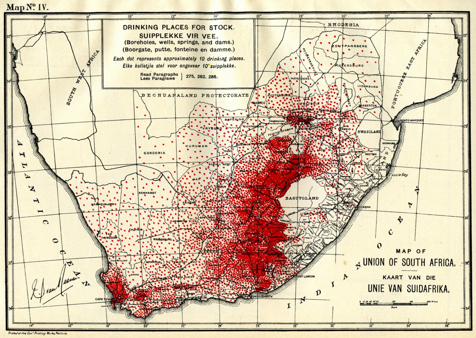
Map IV. Drinking places for stock
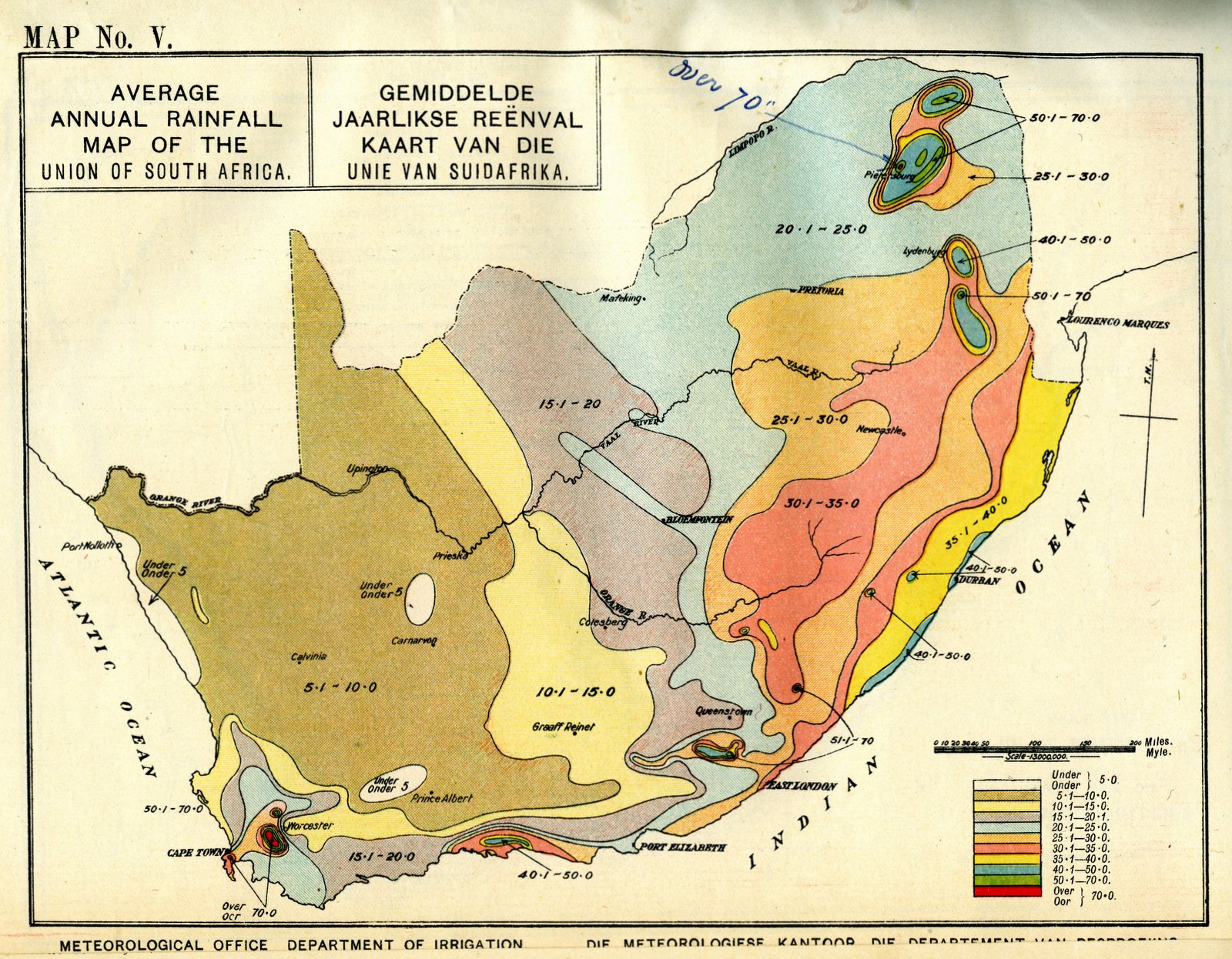
Map V. Average annual rainfall map of the Union of South Africa
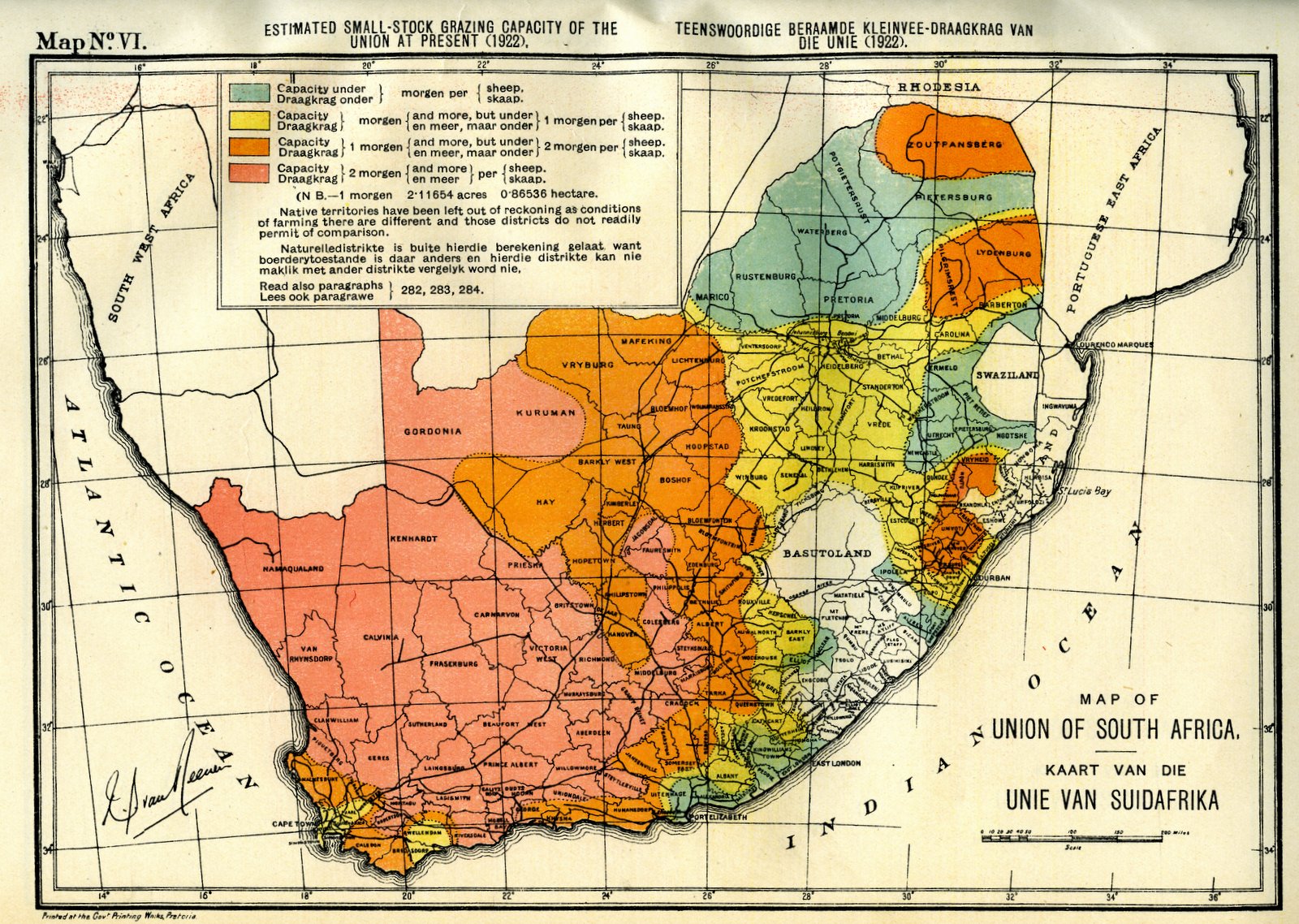
Map VI. Estimated small-stock grazing capacity of the Union at present
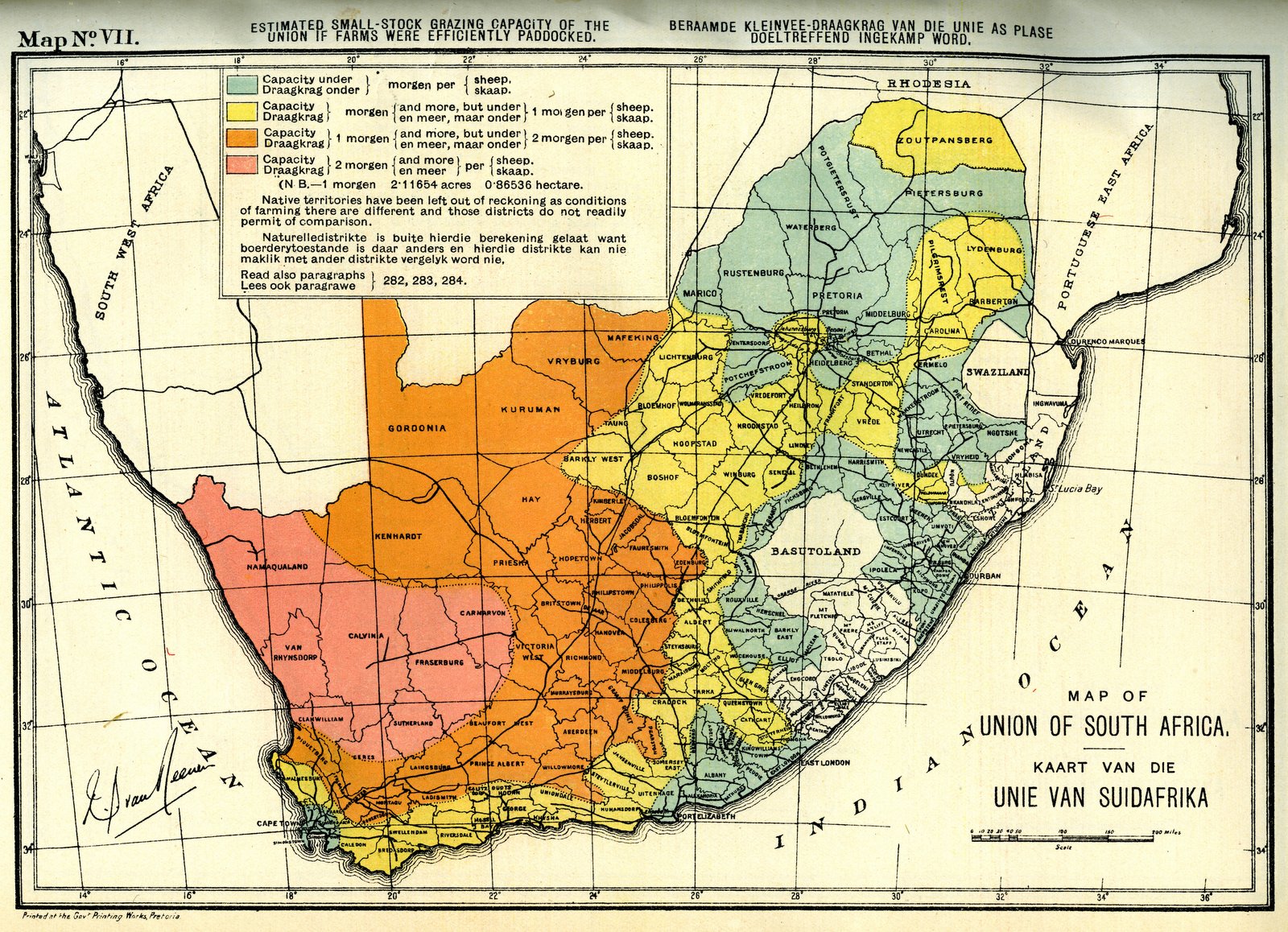
Map VII. Estimated small-stock grazing capacity of the Union if farms were efficiently paddocked
Map VIII. Estimated sizes of paddocks required
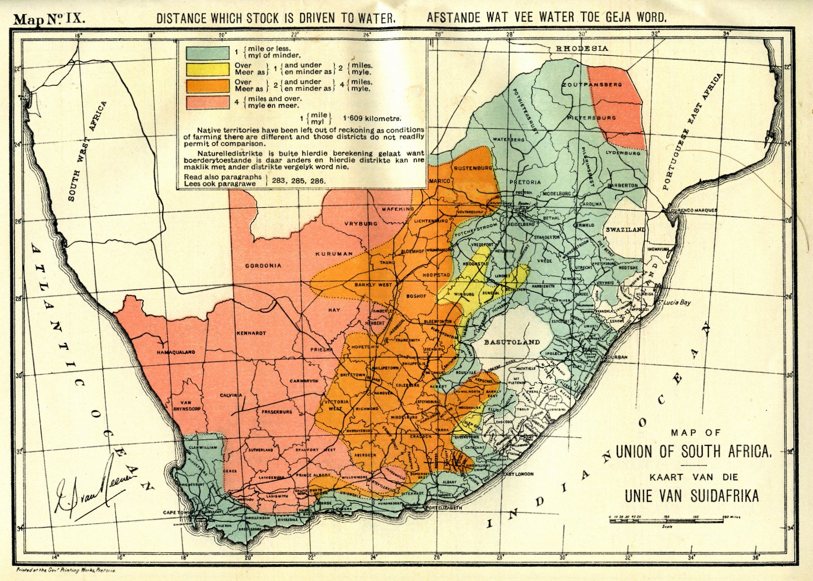
Map IX. Distance which stock is driven to water
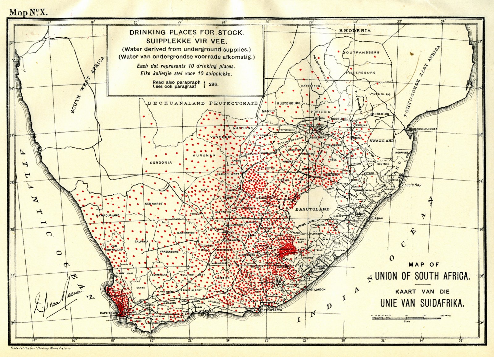
Map X. Drinking places for stock.
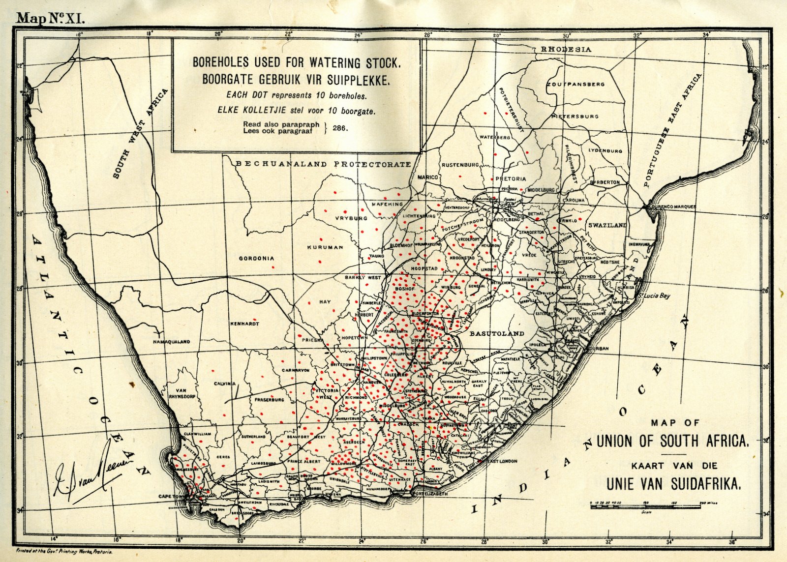
Map XI. Boreholes used for watering stock
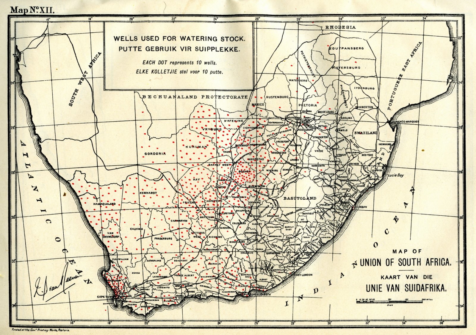
Map XII. Wells used for watering stock
Map XIII. Springs used for watering stock
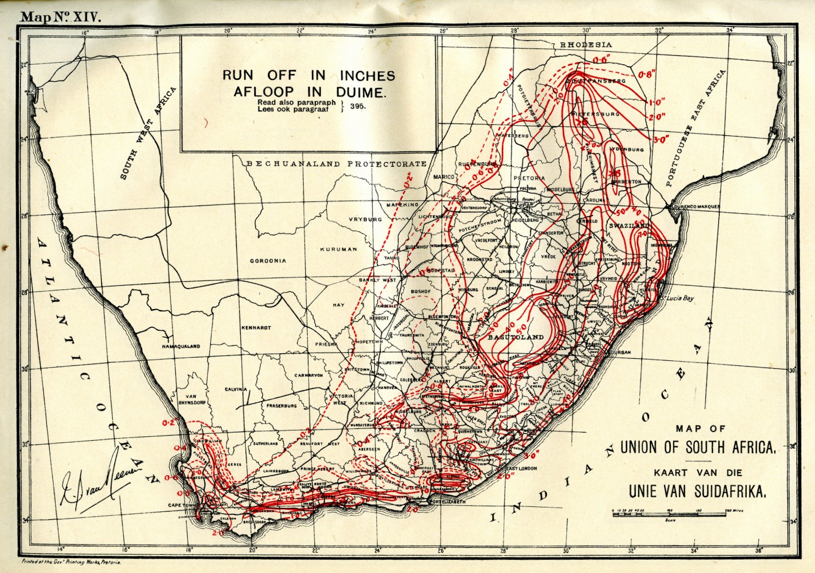
Map XIV. Run off in inches
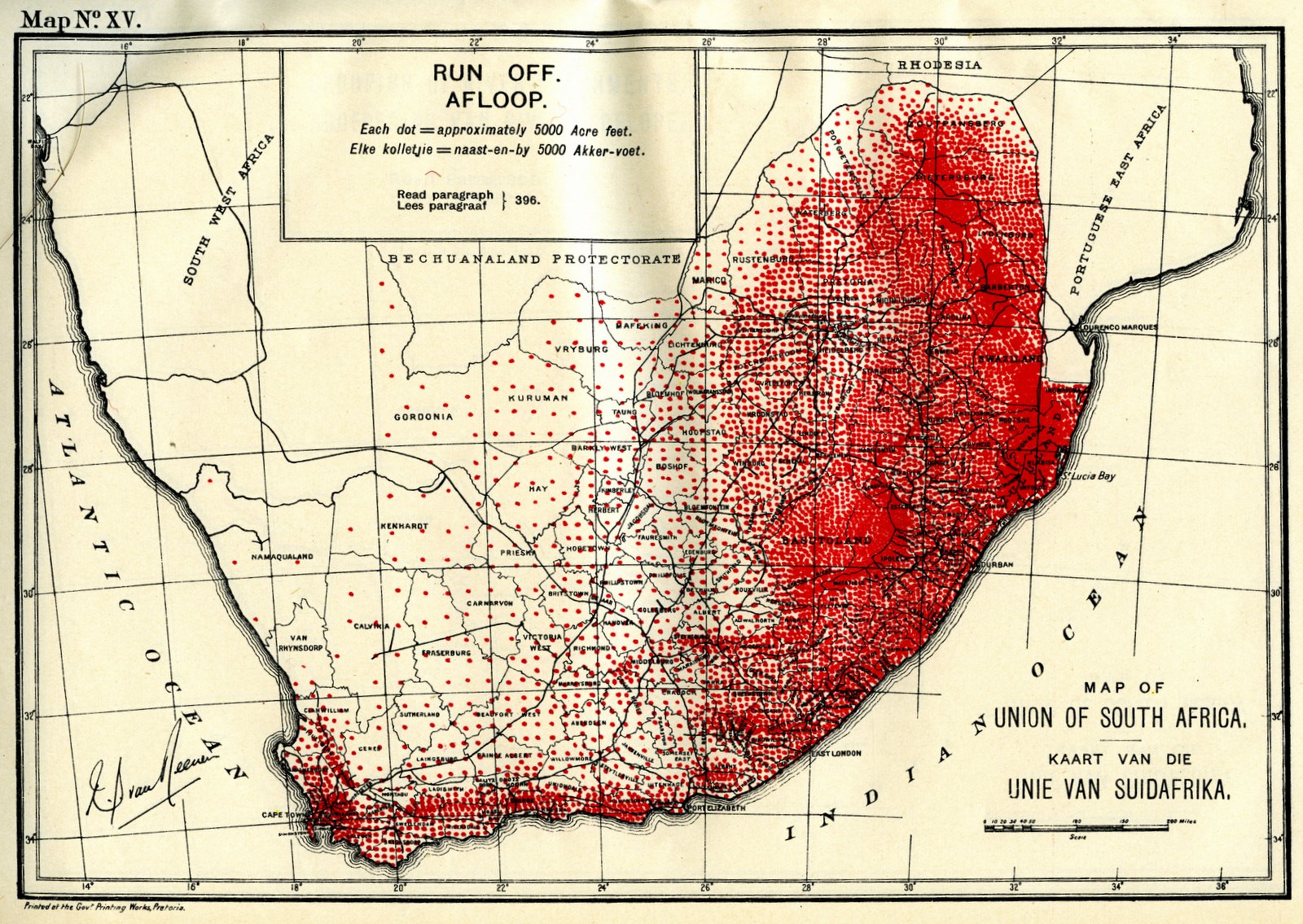
Map XV. Run off
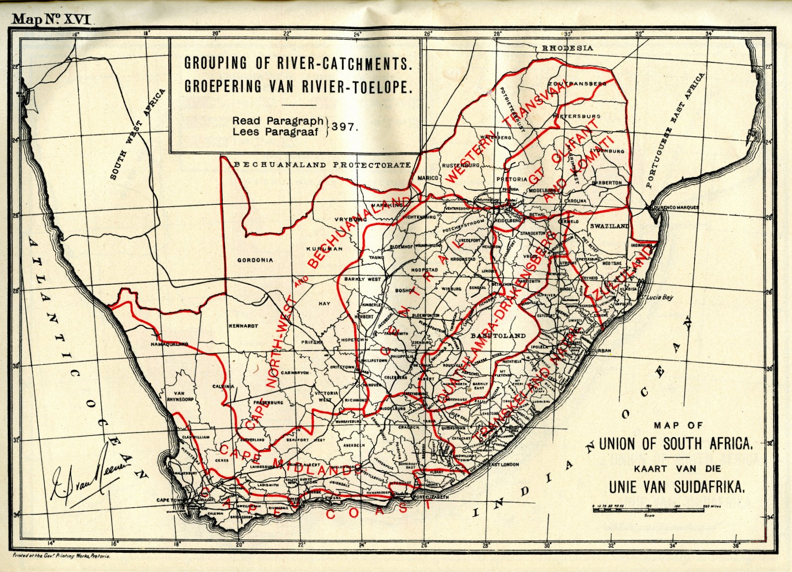
Map XVI. Grouping of river-catchments
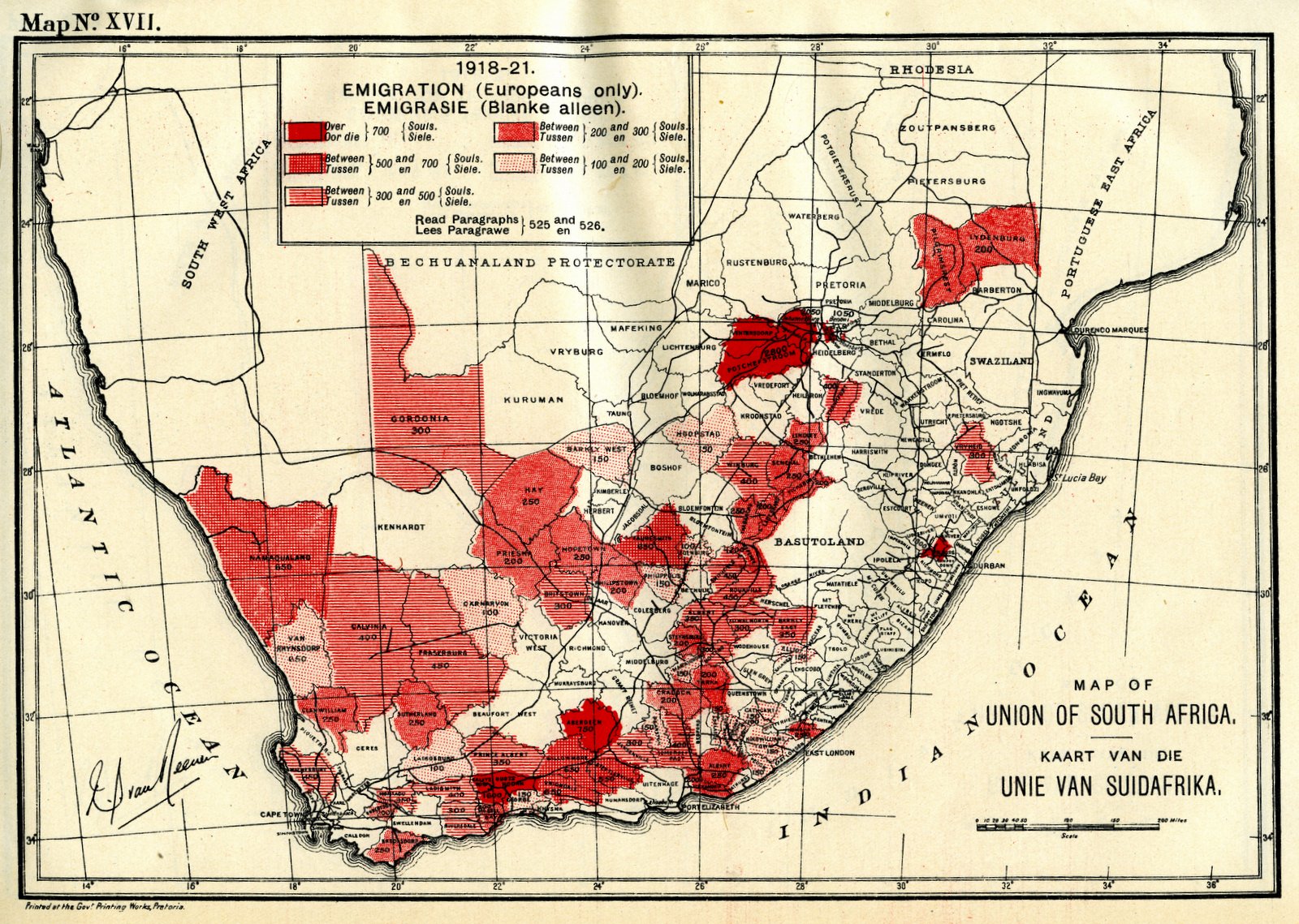
Map XVII. 1918-1921 Emigration (Europeans only)
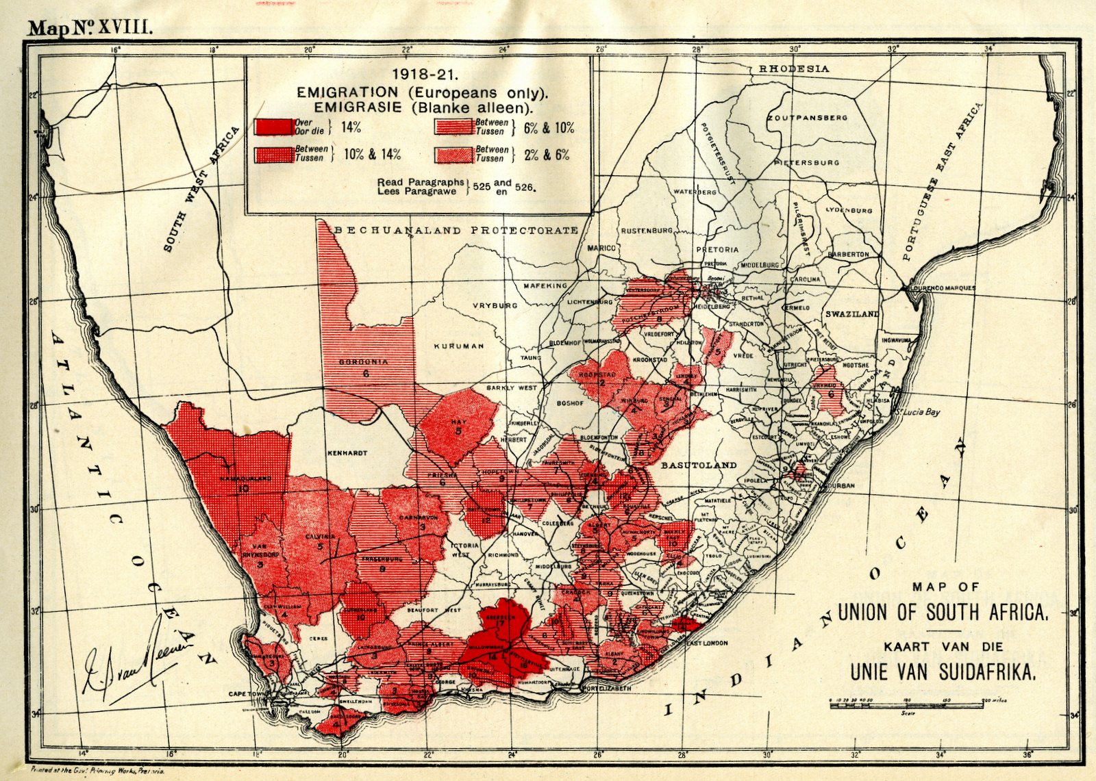
Map XVIII.
1918-1921 Emigration (Europeans only)
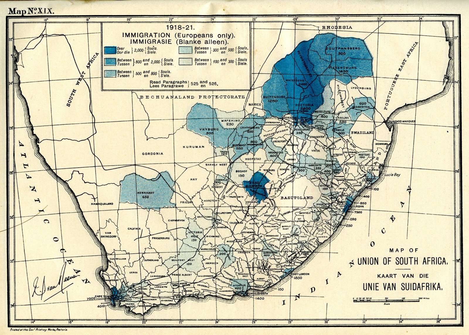
Map XIX. 1918-1921 Immigration (Europeans only)
Map XX. 1918-1921 Immigration (Europeans only)
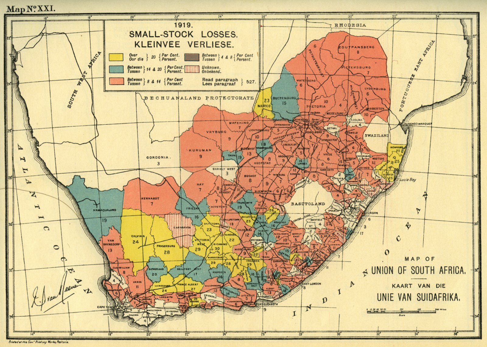
Map XXI. 1919 Small-stock losses
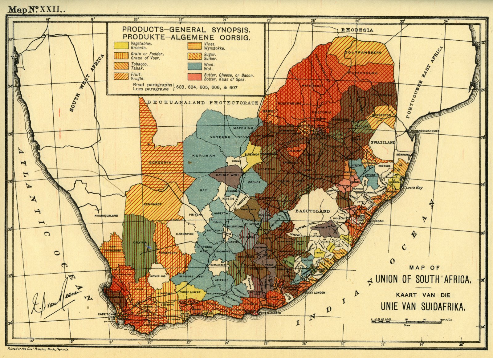
Map XXII. Products - general synopsis
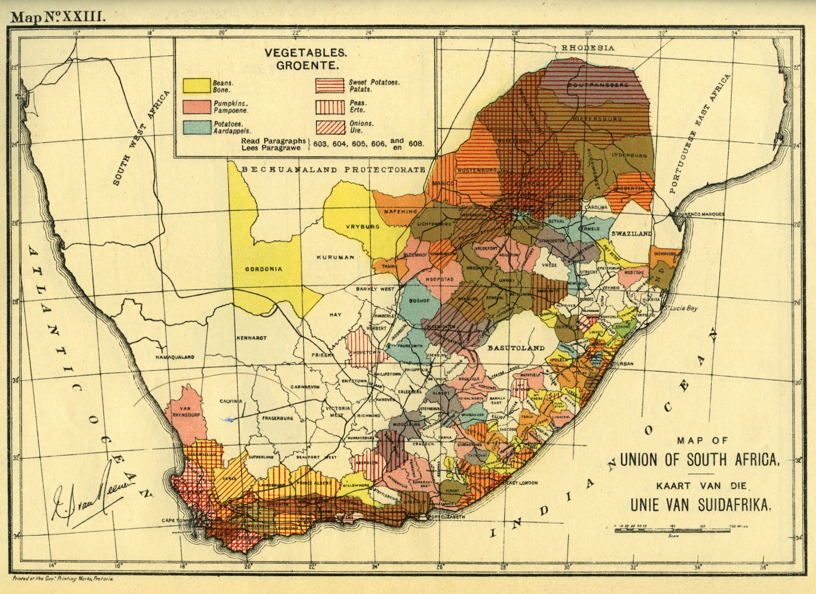
Map XXIII. Vegetables
Map XXIV. Orchards
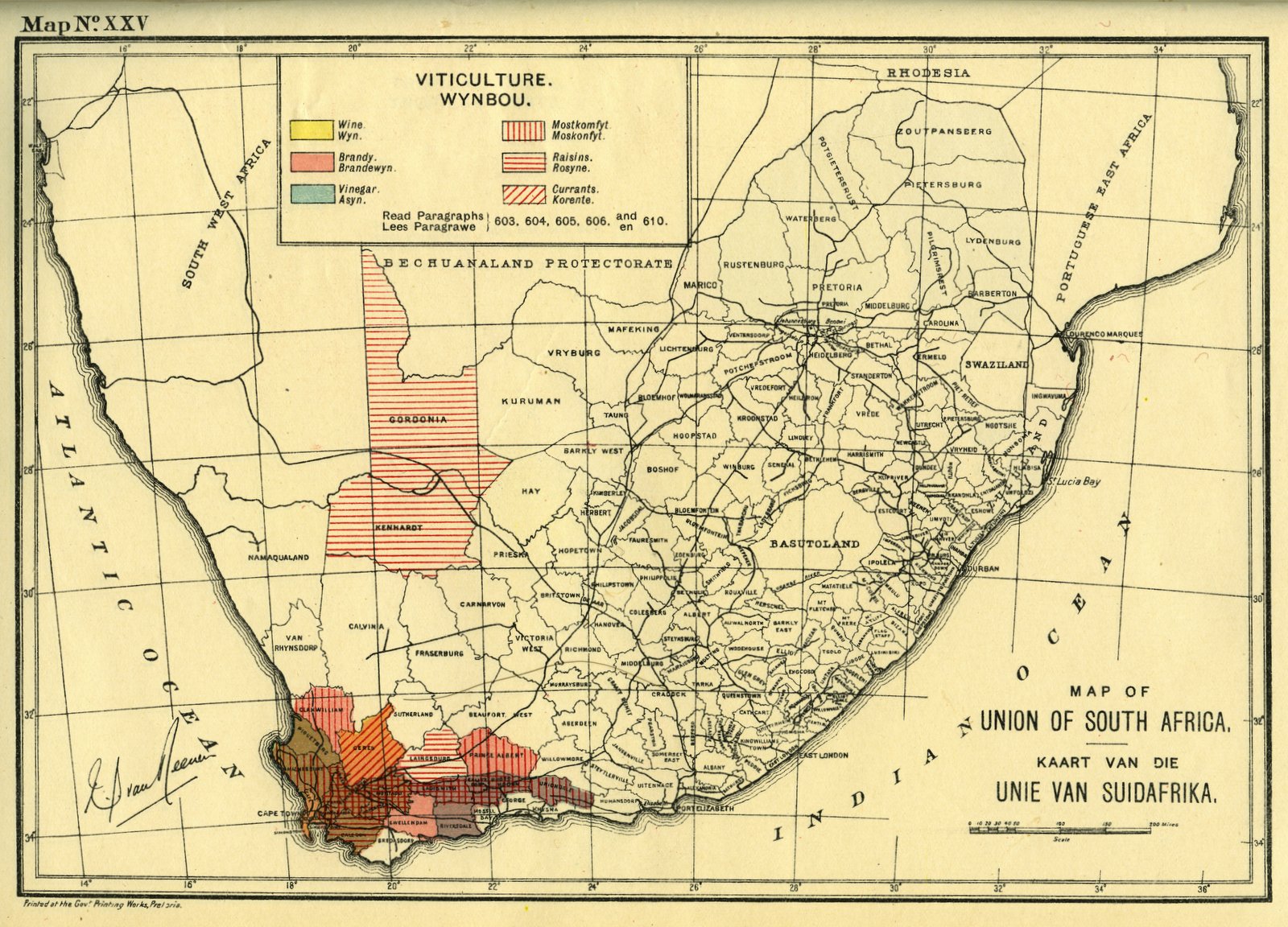
Map XXV. Viticulture
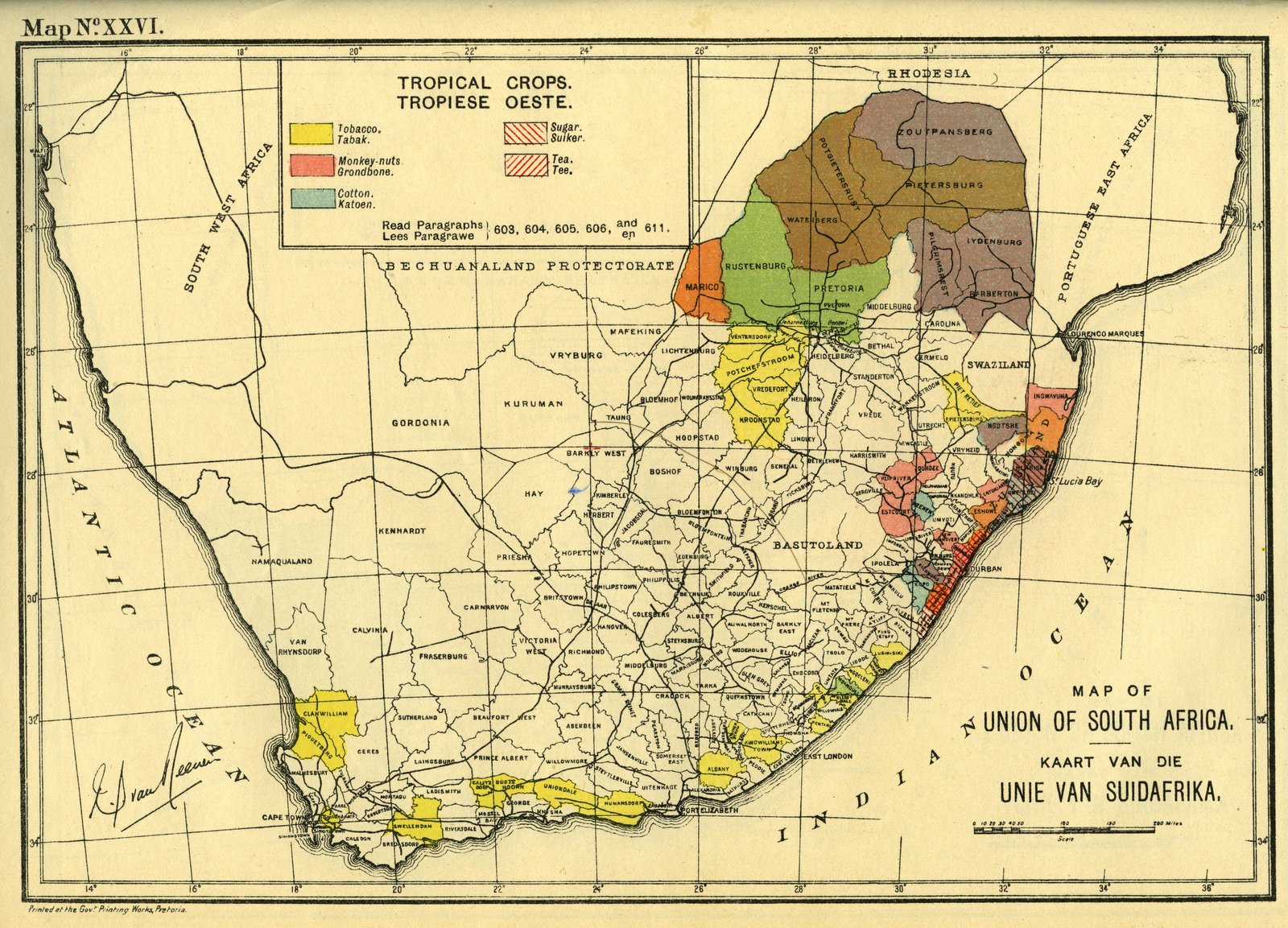
Map XXVI. Tropical crops
Map XXVII. Grain
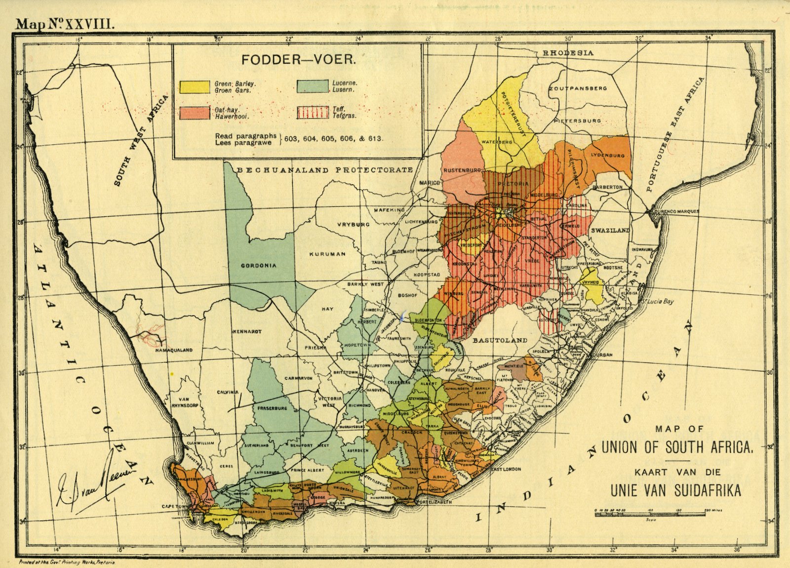
Map XXVIII. Fodder
Map XXIX. Chief fodder producing districts
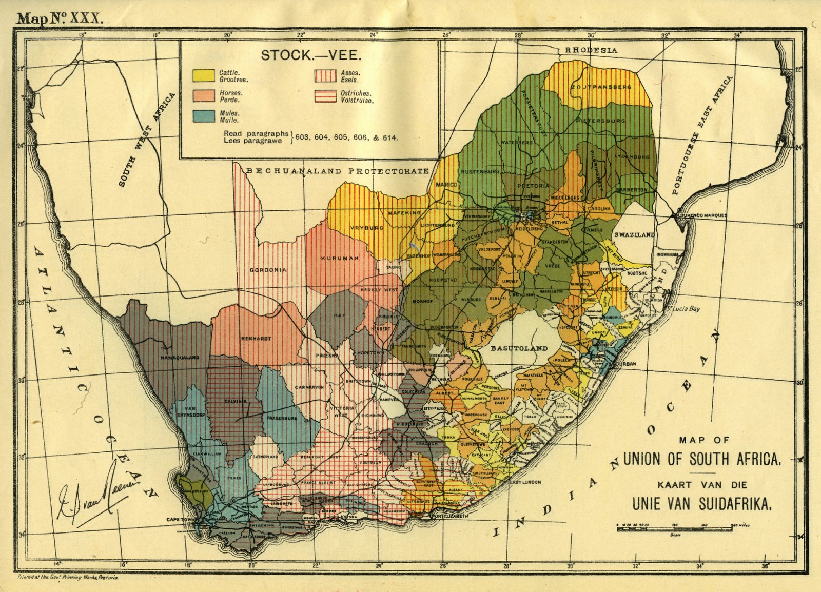
Map XXX. Stock
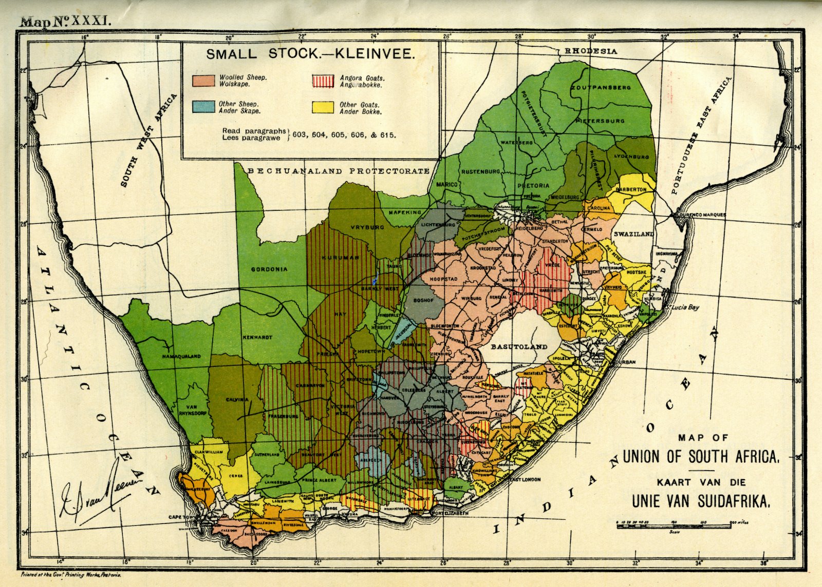
Map XXXI. Small stock
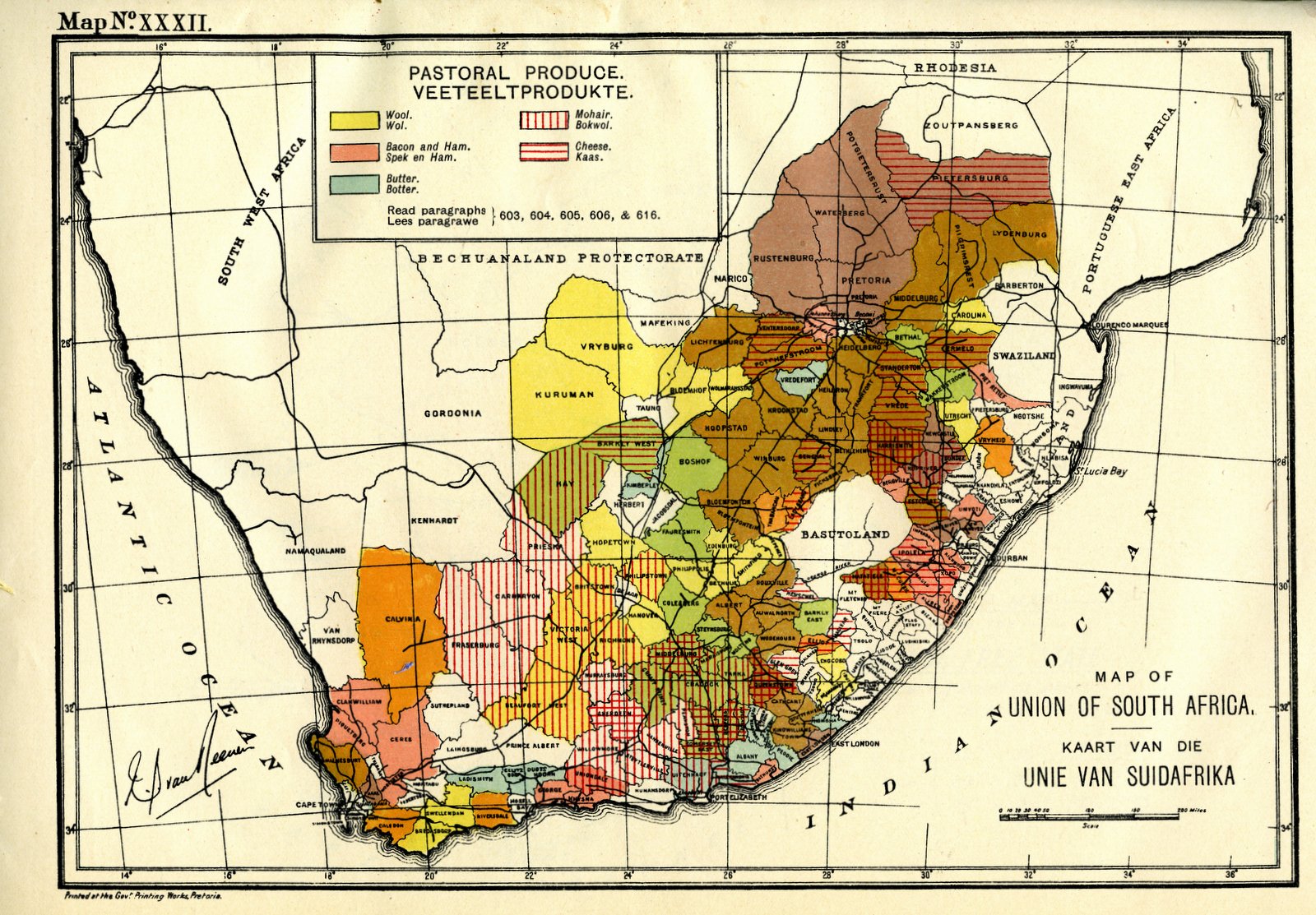
Map XXXII. Pastoral produce
[Map XXXIII]. Sketch map of the Orange Free State

![[Map XXXIII]. Sketch map of the Orange Free State](/uploads/2/1/1/1/21118460/33-map033.jpg)